Key takeaways
- Three valleys, three separate tickets — a Shuangqiao ticket does not get you into Changping. There is no single mountain ticket.
- Shuangqiao is the comfortable one and the main peak is not visible from it. If you came to see Yaomei Peak, you want Changping — or the free roadside viewpoint at Maobiliang.
- The posted last entry is 15:00 for Shuangqiao and 14:30 for Changping and Haizi, and even that is generous: the Shuangqiao shuttle takes 40+ minutes each way, so arriving at 14:00 buys you a ride up and a ride back.
- The ¥150 three-valley combo excludes the shuttles and is void on public holidays. It saves ¥60 on admission, not the ¥150 you will see claimed.
- Sleep in Rilong (日隆) the night before. The town is at 3,200 m and the road in is four hours of mountain driving — day-tripping this from Chengdu is eight hours in a vehicle for a few hours on the ground.
What Mount Siguniang actually is
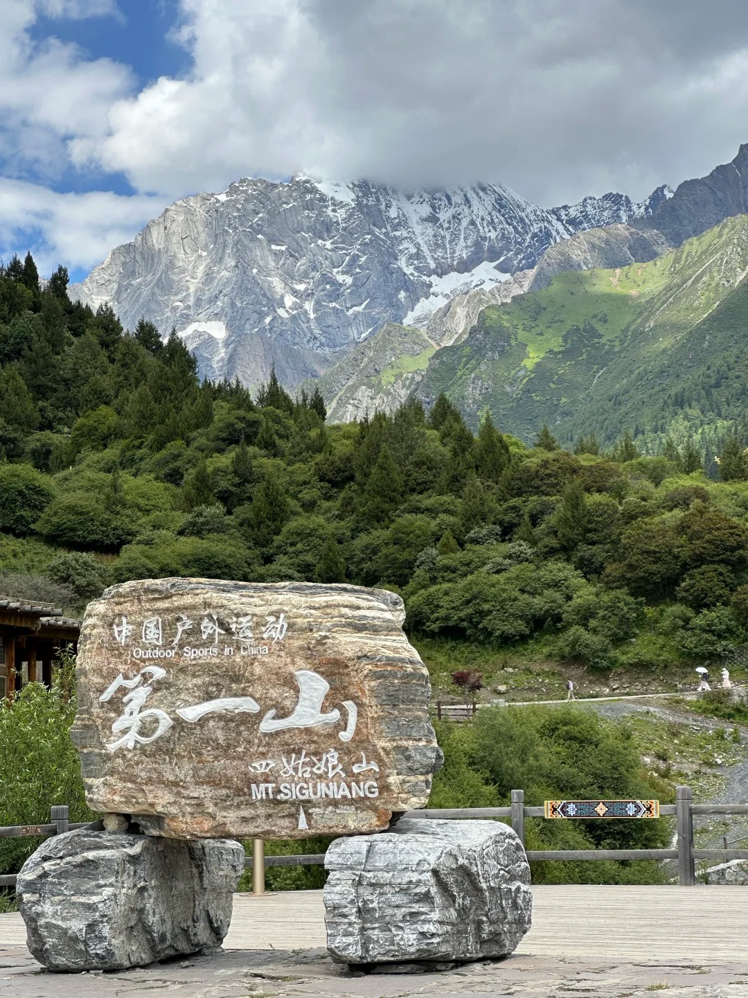
Four summits on one massif, in Xiaojin County in the Ngawa Tibetan and Qiang Autonomous Prefecture, on the eastern edge of the Tibetan plateau. The tallest is Yaomei Peak (幺妹峰) at 6,247.8 m by the October 2023 national re-survey — you will still see 6,250 m quoted almost everywhere, including in older Chinese sources. The other three run 5,355 m, 5,279 m and 5,038 m. Chinese climbers call Yaomei the Queen of Sichuan’s mountains, and it is a serious technical climb; nothing on this page involves going up it.
What makes it worth the drive for an ordinary visitor is the access. This is the most legible high-alpine scenery in Sichuan that needs no permit, no licensed guide and no mountaineering skill — the contrast being Tibet, where a foreign passport means a Tibet Travel Permit, a booked tour and a guide for the whole trip. Here you buy a ticket at a window and get on a bus.
Where Mount Siguniang is, relative to Chengdu
232.8 km by road~4h15Wolong is on the way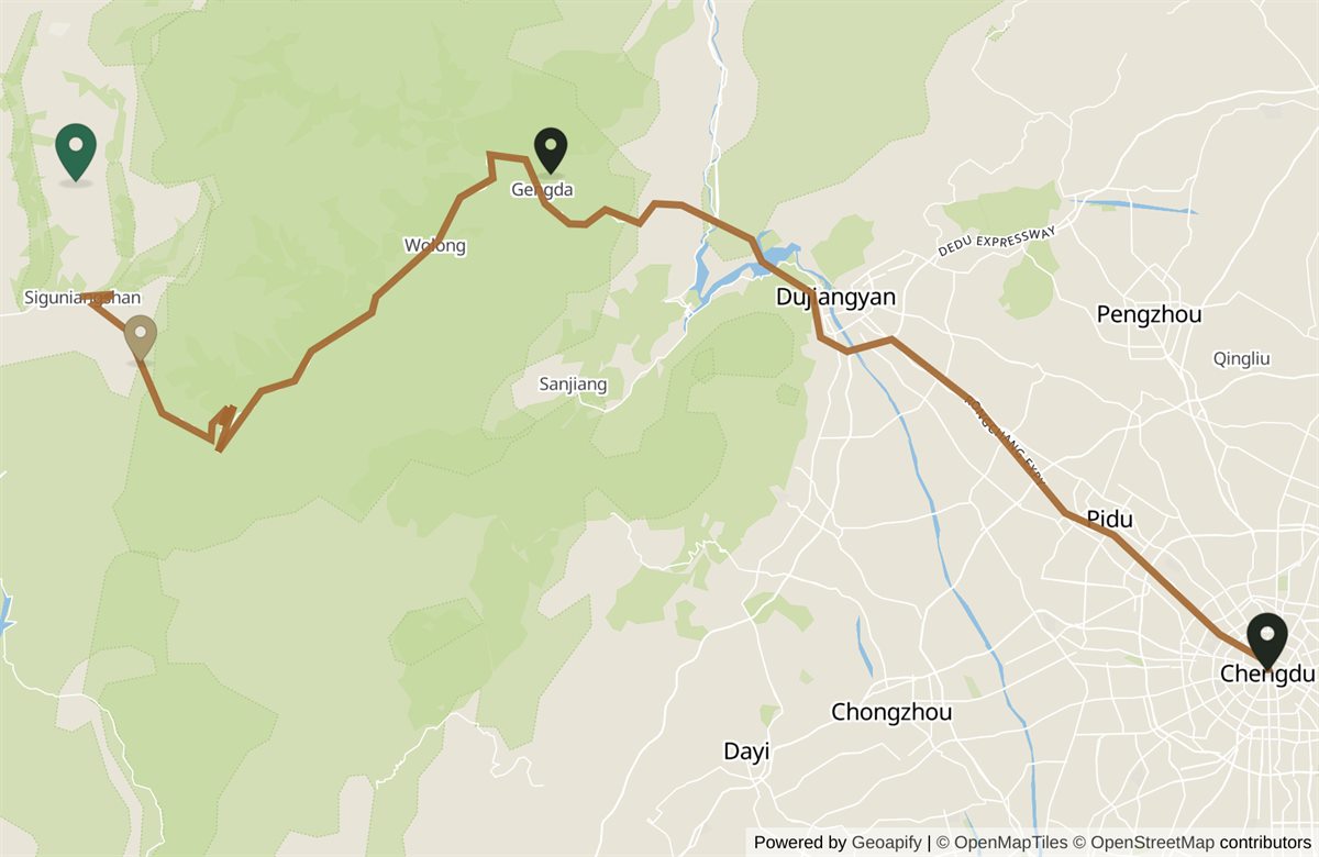 Mount SiguniangMt SiguniangBalang PassBalang PassWolong panda baseWolong pandasChengduChengdu
The name means “four girls mountain” and is sometimes rendered as the Four Sisters Mountain, but almost nobody uses that in English — say Siguniang, which is also what the scenic area calls itself in English on its own signage. One practical consequence of the name: typing or showing 四姑娘山 to a driver or a mapping app navigates to the massif, which is not where any entrance is. Name the valley you actually want.
Which of the three valleys
This is the decision the whole trip turns on, and it is the thing Chinese trip reports say people get stuck on more than anything else. The three valleys are sold separately — a Shuangqiao ticket will not get you into Changping — and they are not variations on one experience. They differ in how much you walk, and in whether you see the mountain at all.
The geometry is the argument, and it is not the one you would guess. All three valleys run north — what is west is Shuangqiao’s gate, which sits 7.58 km from Changping’s in a straight line, 9.5 km and about 18 min by road. Changping and Haizi start beside Rilong town and wrap around the massif, one along its western side and one around to the east, so the summit is in front of you in both. Shuangqiao is a separate, parallel valley with a ridge in between: Yaomei Peak is 10.7 km east of its valley floor, on the far side of that ridge. The comfortable valley is not pointing away from the mountain — it is behind a wall from it, which is why no amount of riding further up it helps.
| Valley | How you move | Main peak? | Time |
|---|---|---|---|
| Shuangqiao 双桥沟 | Shuttle the whole way, boardwalks at each stop. Effectively no walking. | No | 4–5 h |
| Changping 长坪沟 | Shuttle to the Lama Temple, then walk or ride a horse. | Yes, close up | 3 h to Kushutan · 7–8 h to Muluozi |
| Haizi 海子沟 | No shuttle at all. Walk or ride from the gate. | Yes, panoramic | 3–4 h to Chaoshanping · 8 h+ to Dahaizi lake |
| Maobiliang 猫鼻梁 | Roadside. No gate, no ticket, open at any hour. | All four, together | 20–40 min |
The short version. One day and anyone in the party who cannot walk far: Shuangqiao, and stop at Maobiliang on the way past so you have still seen the mountain. One day and you want the peak: Changping as far as Kushutan — 3.5 km of flat boardwalk each way, about three hours, and you are underneath it. Two days: Changping properly, then Shuangqiao. Hill-walking experience and no interest in infrastructure: Haizi.
Inside Shuangqiao the local method is to ride the shuttle straight to the far end at the Sequoia Grove (红杉林, ~3,840 m) and work back down through Potala Peak, Nianyuba and the Ginseng Fruit Meadow — every later stop is then a shorter ride and you never climb.
One naming trap in Changping, because it is where you get off the bus. The shuttle terminus is the temple mapping apps and signs call 斯古拉寺 (Sigula Temple); the “Lama Temple” that English and Chinese trip reports use is the same clearing — 喇嘛寺 is the name on the ranger post 236 m away. Ask for either and you are in the right place.
What it costs, and what the combo does not cover
| Valley | Peak 1 Apr–30 Nov | Low 1 Dec–31 Mar | Shuttle |
|---|---|---|---|
| Shuangqiao | ¥80 · concession ¥40 | ¥50 · concession ¥25 | ¥70, compulsory |
| Changping | ¥70 · concession ¥35 | ¥50 · concession ¥25 | ¥20, to the trailhead only |
| Haizi | ¥60 · concession ¥30 | ¥40 · concession ¥20 | None exists |
The concession is exactly half the full fare in every band. Children under 7 or under 1.2 m go free including the shuttle; visitors over 60 get free admission but still pay for the shuttle.
The scenic area’s notice of 31 January 2026 sells a three-valley combo at ¥150 and any two at ¥110, valid to 31 December 2026. Read the exclusion, because this is the part that circulates wrongly: the notice puts the shuttle tickets outside the offer. The combo therefore discounts admission only — ¥150 against the ¥210 of three separate peak-season tickets, a ¥60 saving — and a Shuangqiao-plus-Changping day still adds ¥90 of transport on top. It is also void on public holidays, which is when a lot of people come. Two further caveats worth knowing: rafting in Shuangqiao (¥90) and all horse hire are outside it as well.
Booking is real-name, one to three days ahead in peak season, through 阿坝旅游网 or the scenic area’s WeChat account — both Chinese-only, and we have not been able to confirm a passport-capable route through either. If you are not set up for Chinese apps, a transfer or day tour that includes admission is the practical answer, and it solves the road at the same time.
Browse transfers from Chengdu →
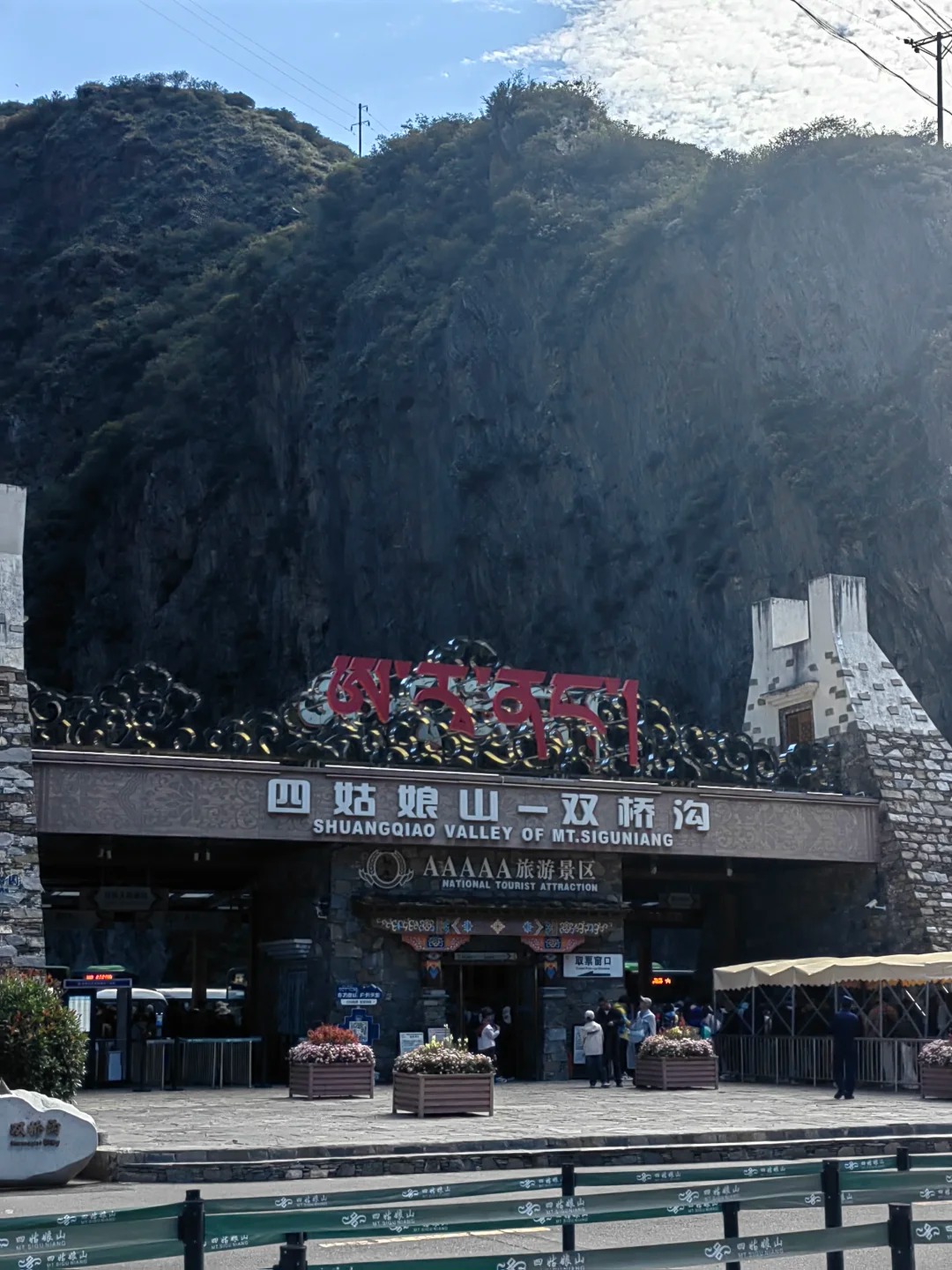
The posted closing time is not the deadline
Gates open at 08:00 from April to November and 08:30 from December to March, and the valleys close at 17:30 and 17:00 respectively. Those are not the numbers that govern your day.
Admission stops at 15:00 for Shuangqiao and 14:30 for Changping and Haizi — a per-valley split that took effect on 1 April 2026, and one that no English-language write-up carries. Thirty minutes sounds trivial until you notice that Changping, the valley with the earlier cut-off, is also the one where the full walk is a seven-to-eight-hour round trip.
And even the cut-off is generous. In Shuangqiao the shuttle takes over 40 minutes each way to reach the head of the valley, so an entry at 14:00 is permitted and buys you a ride up and a ride straight back down. The advice locals give is blunt and correct: be at the gate at 08:00.
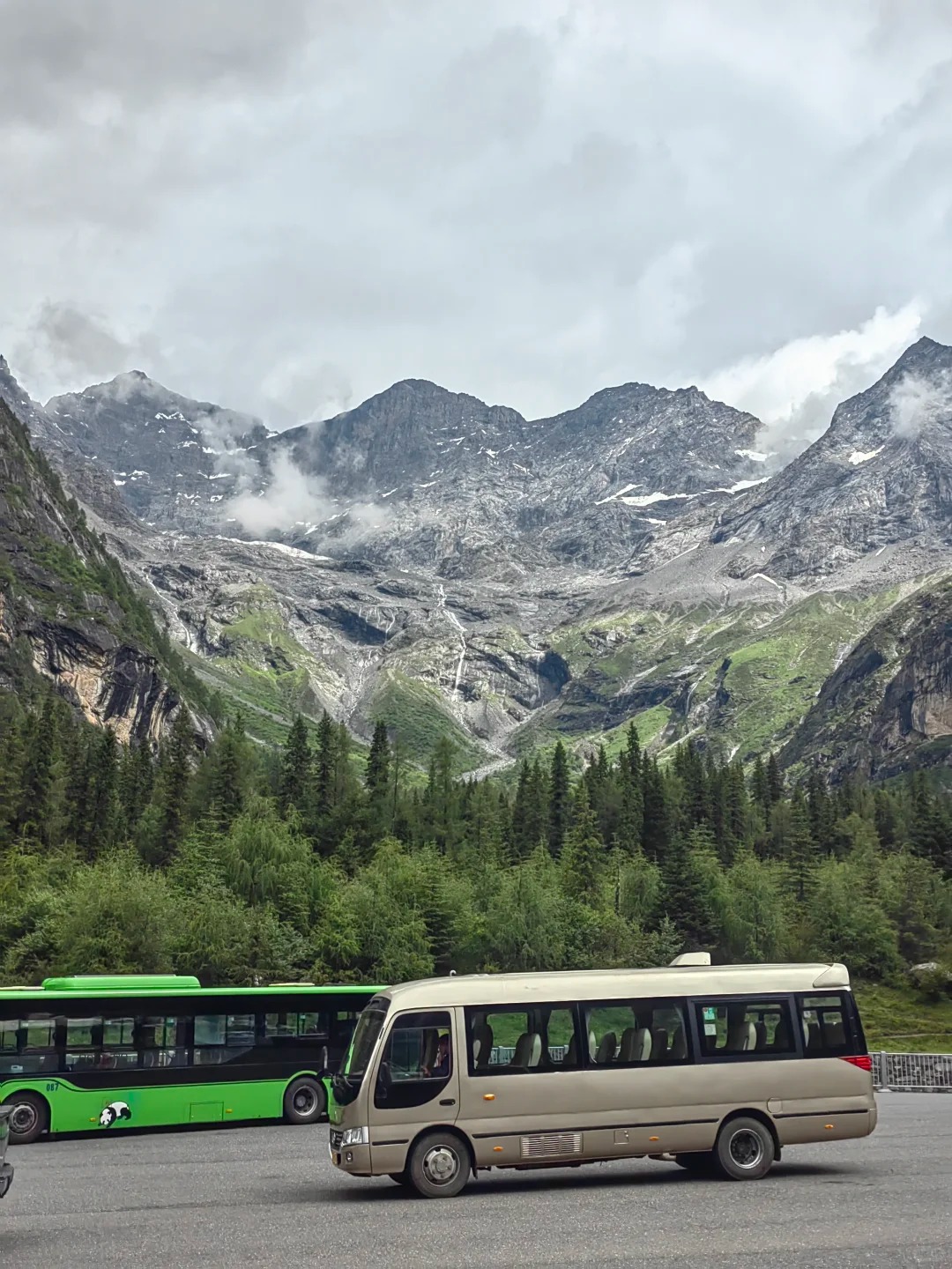
Two consequences worth planning around. The first is that Changping punishes a late start harder than Shuangqiao does, despite being the valley people think of as flexible: its full walk to the Muluozi meadow is seven to eight hours against a gate that stops admitting at 14:30, so anything later than a morning start turns it into the shorter Kushutan walk whether you planned that or not. Decide which of those two you are doing before you leave the town, not at the trailhead.
The second is that this is the argument for sleeping in Rilong rather than driving out from Chengdu on the day. A vehicle leaving Chengdu at 06:00 reaches the gates around 10:15 in good conditions — which works, but leaves no margin at all for the pass, and none of the buffer that snow, roadworks or a queue at the window will eat. Staying in the town turns an 08:00 gate time from a stretch into a short drive.
Altitude, and how seriously to take it
Rilong sits at about 3,200 m. The highest point reachable by shuttle, the Sequoia Grove at the head of Shuangqiao, is around 3,840 m. Haizi Valley climbs past 4,000 m on foot. That is high enough that it needs planning and low enough that it does not need drama.
The standard local practice, and it is worth following: sleep one night in Rilong before you enter any valley; skip the shower and the hair-wash on that first night; walk slowly and do not run or jump; carry glucose. Oxygen canisters are about ¥100 inside the scenic area and ¥15–20 at a Chengdu pharmacy, so buy them in the city if you want them.
Dress for four seasons in a day, in every month of the year. Even in July the local default is a fleece or a light down layer under a windproof shell, with shoes that grip — the boardwalks give way to gravel. Sunglasses matter as much for glare off snow in winter as for UV in summer. If you have a heart or lung condition, take medical advice before committing to a night at 3,200 m.
When to go
Two answers, and they do not compete. Late September to October gives you autumn colour under snow with the clearest air of the year. December to February gives you the most reliable mountain.
That second one is the counter-intuitive part and it is worth stating plainly. The alpenglow on the summits — the reason a lot of people come — is most dependable in autumn and in midwinter, because both deliver dry, cloud-free mornings, while July and August cloud tends to close over the peaks by late morning. Midwinter is also the low-fare season. So the cheapest months and the most reliable views are the same months, which is the reverse of how most Chinese scenic areas price.
March to May is the quietest shoulder, with alpine rhododendron against snow in May. June to August is the fullest for meadows and wildflowers and the best escape from the Sichuan basin heat, but afternoon showers are routine, so put the walking in the morning. The crush is the National Day and Labour Day weeks — and remember the combo ticket is void on public holidays.
Getting there
From Chengdu: 232.8 km, about four and a quarter hours, over the Balang Pass. Coaches for Rilong leave from Chadianzi bus station; a private car runs from around ¥1,200. The tunnel has taken the worst of the old switchbacks out of the drive, but this is still four hours of mountain road, and that is the reason nearly everyone sleeps in the town rather than day-tripping.
From the Wolong panda reserve: 104.9 km, about two hours, on the same road. This is the pairing that makes a two-day trip work — pandas, a night in Rilong, a valley. The scenic area announced a joint ticket with the panda base on 31 July 2026; the notice is on its site but the price and terms were not retrievable, so ask when you book rather than assuming a discount.
In winter, from December to March, the pass ices over and traffic police turn back vehicles that are neither four-wheel-drive nor carrying snow chains. If you are booking a transfer for a winter date, ask the operator about that before you pay. In the June-to-September rains, sustained downpours trigger mudslides that close the access road; the scenic area shuts and turns people away, and has been known to wave visitors into whichever valley is still open. Check the official notice the night before you travel, in any season.
Maobiliang — the view that costs nothing
Maobiliang (猫鼻梁) is a roadside viewpoint on the approach, outside every gate. No ticket, no barrier, open at any hour. It is where the photograph that circulates as this mountain’s signature is actually taken — all four summits in one frame, with the alpenglow on them at dawn — and not, as most people assume, from somewhere deep inside a valley.
Two reasons it belongs in your plan rather than as a footnote. If your day is committed to Shuangqiao, this is how you see the mountain anyway. And on a clear winter morning, before about six, you can have it to yourself. It is the strongest argument on this page that a cheap trip here is not a worse one.
It also solves a problem the ticketed valleys cannot. Alpenglow happens in the first minutes of light, which is well before any gate opens — 08:00 in summer, 08:30 in winter. So the photograph that sells this mountain is structurally impossible from inside a valley: by the time you are through a gate and up a shuttle, the moment has gone. Every version of it you have seen was taken from a roadside, and this is the roadside.
Practically: it sits on the approach road south of Rilong, so it costs nothing to build into the drive in either direction, and a driver will know it by name. If you are staying in the town and the forecast is clear, it is worth setting an alarm for — a ten-minute drive, no ticket, no queue, and the one view on this mountain that does not depend on which valley you picked.
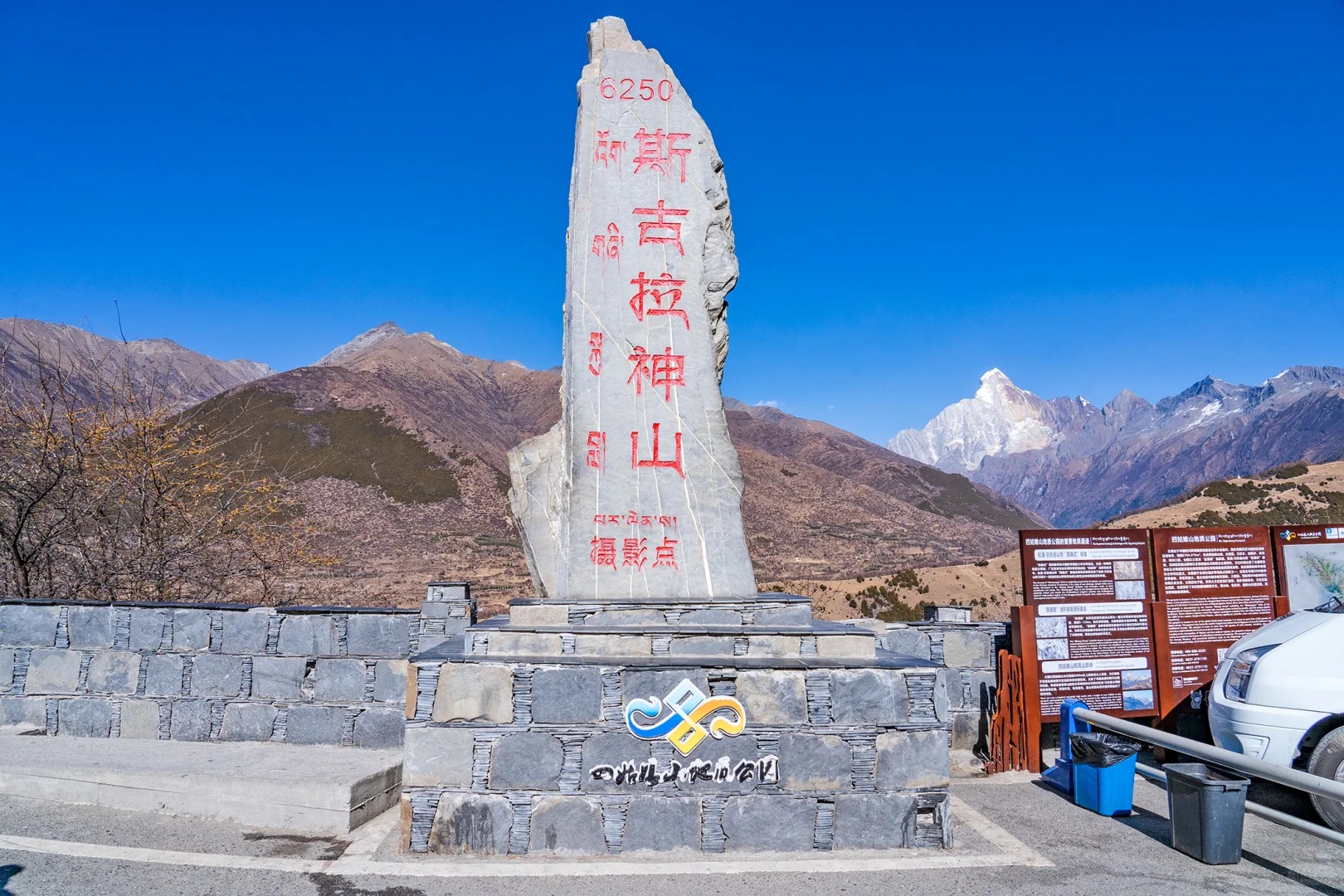
Where to stay
Rilong (日隆), also signed as 四姑娘山镇, is the base and effectively the only sensible one. Staying there the night before you enter a valley is not a comfort preference — it is how you arrive at 3,200 m having slept at altitude rather than having spent four hours climbing to it in a vehicle. Car sickness on the pass is itself a common trigger for altitude symptoms, which is the mechanism most day-trippers do not anticipate.
The town is small and its accommodation is guesthouses and small hotels rather than international chains; book ahead for autumn weekends and the holiday weeks. If you are combining this with the panda reserve, the usual shape is a night in Rilong between the two, not a night at Wolong.
Planning two or more days out here? The pairing that works is the panda reserve and one valley, with a night in Rilong between them — see where to see pandas in China for how the Wolong half fits, and the Chengdu itinerary guide for where it sits in a longer Sichuan trip.
Frequently asked questions
How do you pronounce Siguniang, and what does it mean?
[srr-goo-nyang] — 四姑娘山 (Sìgūniang Shān) means 'four girls mountain', usually rendered in English as the Four Sisters Mountain. You will almost never see that English name used in practice, including by English-speaking climbers, who say Siguniang. The four are the four summits of one massif, and the tallest of them — the one everybody photographs — has its own name, 幺妹峰 (Yāomèi Fēng), 'the youngest sister'. If you are showing a driver a phone screen, 四姑娘山 is the string to show, but be aware it will navigate to the massif rather than to any gate, which is a real cause of wasted mornings.
Which of the three valleys should I choose if I only have one day?
If you want the easiest day and are travelling with anyone elderly, small or unacclimatised, take Shuangqiao Valley — a shuttle runs the whole way and you get off at boardwalk viewpoints. Understand what you are trading: the main peak is not visible from Shuangqiao. If seeing Yaomei Peak is the reason you came, take Changping Valley instead; the shuttle drops you at the Lama Temple and it is 3.5 km of flat boardwalk each way to Kushutan, about three hours return, with the peak in front of you. Haizi Valley is the third option and it is a hill day, not a sightseeing one — no shuttle exists there at all. And if your day is already committed to Shuangqiao, stop at Maobiliang on the way in or out: it is a free roadside viewpoint that shows all four summits together, and on a clear morning it is arguably better than anything inside a gate.
How much does it cost, and is the combined ticket worth buying?
In peak season (1 April to 30 November) admission is ¥80 for Shuangqiao, ¥70 for Changping and ¥60 for Haizi. Shuttles are separate and are not optional: ¥70 in Shuangqiao, where no private vehicle enters and there is no walking alternative, and ¥20 in Changping, which only carries you as far as the trailhead. Haizi has no shuttle. From 1 December to 31 March those admission prices drop to ¥50 / ¥50 / ¥40. The scenic area's own notice of 31 January 2026 sells a three-valley combo at ¥150 and any-two at ¥110, valid to 31 December 2026 — but read the exclusion, because it is the part that gets misreported: the notice puts 观光车票, the shuttle tickets, outside the offer. So the combo saves ¥60 against the ¥210 of three separate admissions and nothing at all on transport, and it does not apply on public holidays. For most visitors doing one or two valleys in a single trip, it is not worth the arithmetic.
What time do I actually need to arrive?
Earlier than the posted cut-off implies. Admission stops at 15:00 for Shuangqiao and 14:30 for Changping and Haizi — a per-valley split that took effect on 1 April 2026 and that no English-language source carries. But the binding number is the shuttle: in Shuangqiao it takes over 40 minutes each way to reach the Sequoia Grove at the head of the valley, so an entry at 14:00 is legal and pointless. Changping is worse in a different way, because the valley's full walk to the Muluozi meadow is a seven-to-eight-hour round trip against a 14:30 gate. Locals simply say be at the gate at 08:00, and that is the correct advice.
How bad is the altitude, and what should I do about it?
The town sits at about 3,200 m and the highest point you can reach by shuttle — the Sequoia Grove at the head of Shuangqiao Valley — is around 3,840 m. Haizi Valley goes past 4,000 m on foot. That is high enough to matter and not so high that it is exotic: the standard local practice is to sleep one night in Rilong before entering any valley, skip the shower and the hair-wash on that first night, walk slowly, and carry glucose. Oxygen canisters sell for around ¥100 inside the scenic area and ¥15–20 at a pharmacy in Chengdu, so buy them before you leave the city if you want them. Anyone with heart or lung conditions should take medical advice before committing to a 3,200 m overnight.
When is the best time of year to go?
Late September to October for colour, and December to February for the clearest mountain. Those two answers are not in competition: autumn gives you turning larch and birch under snow with the year's clearest air, and midwinter gives you the highest chance of a cloud-free summit at dawn. The counter-intuitive part is that the alpenglow everybody comes for is most reliable in exactly those two windows, because both deliver dry mornings, while July and August cloud tends to close over the summits by late morning. Midwinter is also the low-fare season, so the cheapest months and the most reliable views are the same months — which is the opposite of how most Chinese scenic areas price. Spring brings alpine rhododendron against snow in May and is the quietest shoulder; summer is the fullest for meadows and wildflowers and the best escape from the Sichuan basin heat, but put the walking in the morning because afternoon showers are routine.
Do I need to book in advance, and can I book on a foreign passport?
Booking is real-name and the scenic area advises one to three days ahead in peak season, with a daily cap. In July and August online stock is commonly gone days out; travellers who queue at the gate window from about 07:00 usually get in, but describe it as a gamble. The official channels — 阿坝旅游网 and the scenic area's WeChat account — are Chinese-only, and we have not confirmed a passport-capable path through either. In practice the workable English route is a booked transfer or day tour that includes admission, which also solves the road. Under-7s and children under 1.2 m go free including the shuttle; over-60s get free admission but still pay for the shuttle.
Can I combine Mount Siguniang with the Wolong panda base?
Yes, and it is the standard two-day pairing, because Wolong sits on the same road. The reserve is 104.9 km from the scenic area, about two hours' drive, so a typical shape is pandas on day one, sleep in Rilong, a valley on day two. Note that the scenic area announced a joint ticket with the Wolong panda base on 31 July 2026; the notice exists on the operator's site but its price and terms were not retrievable when this page was written, so ask when you book rather than assuming a discount.
Can I get there and back from Chengdu in one day?
You can, and almost nobody who has done it recommends it. It is 232.8 km each way and about four and a quarter hours of mountain driving over the Balang Pass, so a day trip is roughly eight and a half hours in a vehicle for a few hours on the ground — and car sickness on the pass is itself a common trigger for altitude symptoms. Sleeping one night in Rilong is not a comfort upgrade; it is how you arrive acclimatised. Coaches leave from Chengdu's Chadianzi bus station (茶店子客运站); the destination is written 日隆 or 四姑娘山镇 on the board and on the ticket, and both refer to the same town — show the characters rather than saying Rilong, which a ticket clerk may not recognise in English.
What about driving in winter — is the road open?
None of the three valleys closes for winter, and the tunnel has taken the worst of the old Balang Pass switchbacks out of the drive. What does change is enforcement: from December to March the pass ices over and traffic police turn back vehicles that are neither four-wheel-drive nor carrying snow chains. If you are booking a private transfer for a winter visit, that is a question to ask the operator before you pay. In the June-to-September rains the risk is different again — sustained downpours trigger mudslides that close the access road, and the scenic area shuts and turns people away when that happens. Check the official notice the night before you travel, in any season.
Sources
Checked August 2026 · Written from our own first-hand travel in China.